Picture of Ken Lavin

Ken Lavin

Our Six Favorite Bay Area Summer Hikes

It’s summertime and the living is easy! Whether you are venturing outside on a hot summer day (heatwaves are more frequent these days), or enjoying a cool, foggy adventure, there are plenty of Bay Area hikes to explore.

We asked some of our outing leaders—volunteers who lead hikes throughout the Bay Area—about our favorite trails around the Bay for this time of year. Bring your friends, family, and maybe even your pets to explore with you! Don’t forget to stay hydrated.

Lagoon Trail in Marin, by Ken Lavin

For a delightful, dog-friendly summer hike, one of my favorites destinations is the Lagoon Trail in the Marin Headlands. The path begins at the west end of the old visitor center parking lot. Head straight at the trail junction and follow the gentle, one-mile footpath through a cornucopia of coastal plants to Rodeo Beach, renowned for its beautiful gravel and sand. Rodeo Beach is a great place to enjoy a picnic lunch and let your canine companion romp.

Address: 948 Fort Barry, Sausalito 
What to bring: Dress in layers, bring lunch and water.
Website: Rodeo Beach and Lagoon

Ken worked as a national park ranger in the Golden Gate National Recreation Area and as an instructor for Diablo Nature Adventures, teaching environmental science to school groups in Mount Diablo State Park. He's been leading the Outings Program for more than 10 years.
Ken Lavin
Ken Lavin
Outings Coordinator

Limantour Beach, By David Schmidt and Serena Enger

On the hottest days of the year, the coolest place to go is Limantour Beach. From Olema, take Bear Valley Road about 1.5 miles to Limantour Road, turn left onto it, and take Limantour Road about 10 miles to the two parking areas near the beach on Drakes Bay. Take the short trail through the wetland to the beach, watching for birds in the wetland, then turn right onto the beach and walk a mile or two, which puts you on Limantour Spit, with the Estero de Limantour on one side and Drakes Bay on the other.


Bring binoculars to see the seals on the opposite shore of the Estero and watch for unusual sea creatures that may wash up on the Drakes Bay shore. The beach is long, uncrowded, and guaranteed to cool you off—but bring a windbreaker and warm clothes, because sometimes it’s windy and foggy in summer.

Photo credit: Sodai Gomi via Flickr

Address: Limantour Beach Trailhead
What to Bring: Lunch, Water, Dress in Layers
Website: Limantour

David Schmidt is an environmental historian and recently retired writer and editor for the U.S. Environmental Protection Agency’s regional office in San Francisco. Serena Enger has enjoyed a lifetime of camping and hiking across North America’s local, state, and national parks.
David Schmidt and Serena Enger
Outings Leaders

Endless Falls, by James Kim

My favorite “anytime” hike is on Mt. Tam in Marin County. Start at the Rock Springs parking area off Pantoll Rd and the Panoramic Hwy. Access the cataract trail behind the parking area and hike parallel to the creek. Just when you think the cascading water views have peaked, it keeps getting better. It’s about 7 miles round trip if you reach Alpine Lake but, in case you get tired, enjoy your picnic and return the same way you came. Be aware that there’s more elevation coming back up so plan accordingly. The water flows down the mountain all year round but the falls are especially breathtaking after a storm. Enjoy!

Photo credit: Fabrice Florin via Flickr

Address: Rock Springs Trailhead, W Ridgecrest Blvd, Stinson Beach
What to Bring: Lunch, water, dress in layers
Website: Mount Tamalpais State Park

Dr. James and Marta Kim are avid hikers who like to share memorable outdoor experiences in the Bay Area. Together since 1989, they are now retired but worked together in a dental office on the Peninsula for over 10 years.
James Kim
Outings Leader

Tilden Park – Seaview Trail, By Alan Siegel

The Sea View Trail in Tilden Park is a part of the Bay Area Ridge Trail and offers gorgeous 360-degree views that stretch from the Farallon’s Islands to Mt Diablo and even to the Sierra snowcaps on clear days. Departing on a wide path from the upper Tilden Steam Train parking lot, our destination is a funky hilltop labyrinth set inside a former Nike launch pad. Along the way, you will see a century-old stone wall, diverse wildflowers, soaring red-tail hawks, and many medicinal edible and useful plants used for centuries by indigenous people.

Bring a windbreaker on windy or foggy days, lunch, water, and poles if you use them. The trail is wide but rocky in some places. Hiking shoes are recommended.

Address: Tilden Steam Train Parking, Orinda
What to bring: dress in layers, poles if you use them, hiking shoes, lunch, water
Website: Tilden Park

Alan Siegel has hiked the East Bay hills almost daily since the early 1970's, trying to learn every plant and its edible, medicinal, and cultural uses, and to discover and use native plants that thrive in gardens.
Alan Siegel
Outings Leader
The view from Lands End

San Francisco's Lands End, by Gail MacGowan

As a city-dweller, I don’t have to travel far for my beloved summer hike. San Francisco’s Lands End is easily accessible by the SF Municipal Transit #38 bus line to 48th Avenue and also offers free parking options.

Before heading out on the Coastal Trail, take a few minutes to explore Sutro Heights, whose entrance is marked by two large lion sculptures. Here, overlooking the vast Pacific Ocean, in the late 1800s Adolph Sutro transformed the sand-covered outcropping into lush gardens and opened them free to the public.

Crossing Point Lobos Boulevard, you encounter the venerable Cliff House restaurant (set to reopen in the future), the ruins of Sutro Baths, and the Lands End Visitor Center. Heading north on the Coastal Trail, you round a curve to encounter a magical view of the Golden Gate Bridge—unless it’s totally enveloped in fog. The trail, roughly following an old steam train road, offers gorgeous views of the vast Pacific Ocean. You’ll encounter lots of timber and dirt stairs as you wind your way up the coast to Eagles Point. There you can double back past the Palace of the Legion of Honor and catch the Camino del Mar Trail to loop back to your starting point.

Address: 680 Point Lobos Ave, San Francisco
What to bring: Water, snacks, dress in layers
Website: Land’s End

Gail MacGowan is a native Californian (with forebears who got here in 1852) who grew up in Salinas. She was a professional singer, and recently retired from a career in non-profit fundraising.
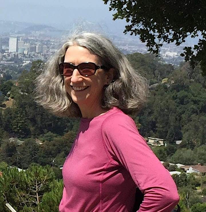
Gail MacGowan
Outings Leaders

Piedmont Trail through Baltimore Canyon, in Larkspur, By Cathy Petrick

For a completely shady hike on a hot summer day, I recommend the Piedmont Trail that follows Larkspur Creek under towering redwoods, crossing several wooden footbridges, and offering opportunities for kids and dogs to play in shallow sections of the creek along the way. The Piedmont Trail ends at the canyon’s terminus, at the base of Dawn Falls. The falls will be dry in summer, so don’t bother climbing up the steep Dawn Falls Trail unless you intend to hike a longer loop connecting to trails above the canyon. I usually turn around at the giant boulder that marks the end of the Piedmont Trail, and I retrace my steps, which makes a pleasant 3.75-mile round trip.

Address: Piedmont Road/Coleman Avenue junction, Larkspur 
Where to park: Park along Piedmont Road, in the 3–30 block between Magnolia Avenue and the outlet of Coleman Avenue (which is one-way).
What to bring: Water, a leash (dogs must be leashed on this trail)
Website: Baltimore Canyon, Marin County Parks, map

Cathy is a former park ranger from Yellowstone National Park and the Golden Gate National Recreation Area who loves wildflowers, dogs, and baking. She is an identical triplet.
Gail MacGowan
Outings Leaders

Become an Outing Leader

Are you interested in leading an outing to your favorite place? Reach out to me to learn more about how to become an Outings Leader. Email klavin@greenbelt.org

Share this post

KEEP READING

Related Posts

Scroll to Top