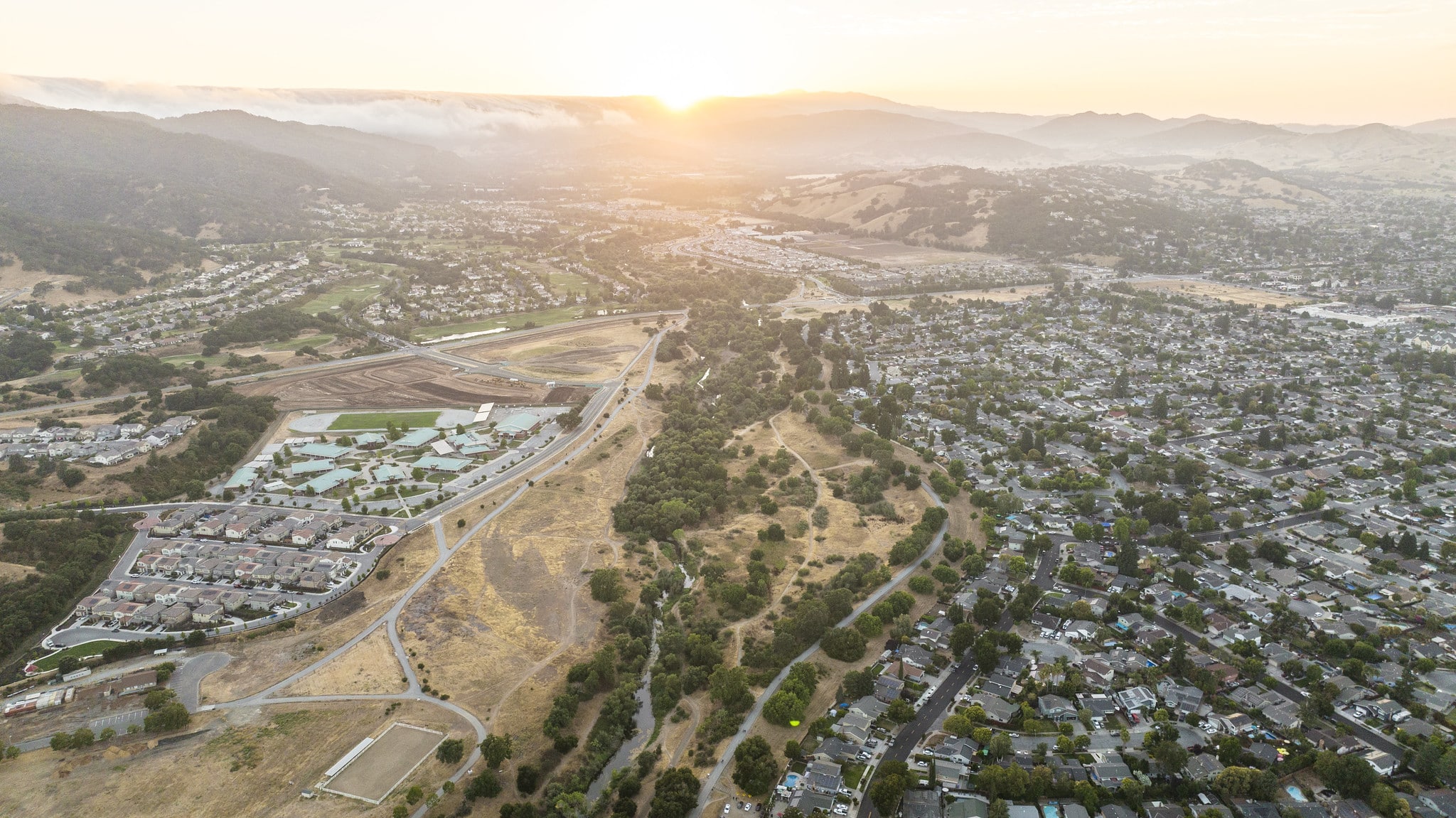
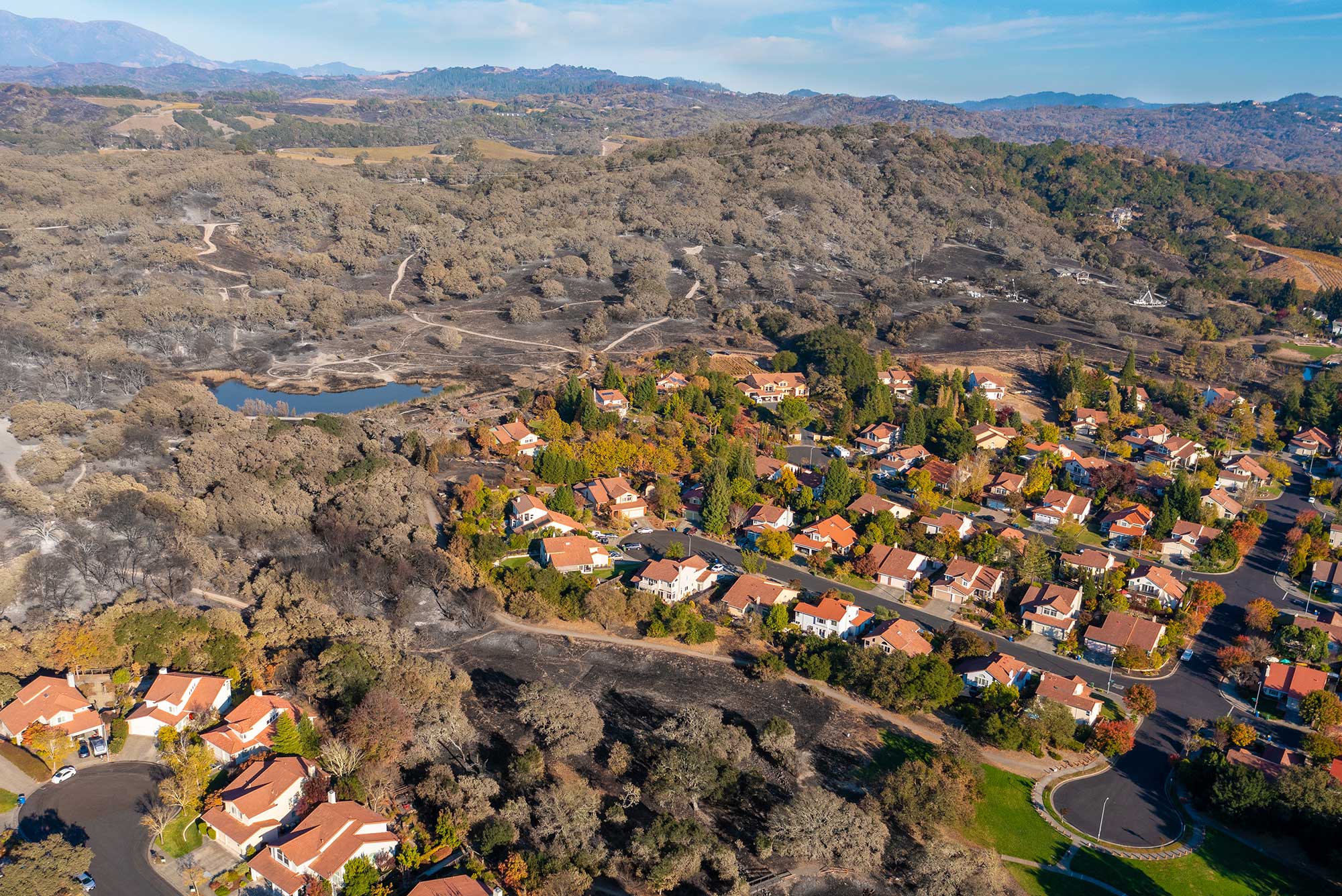
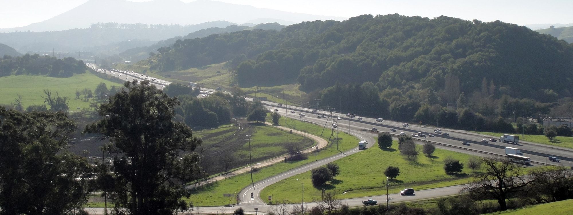
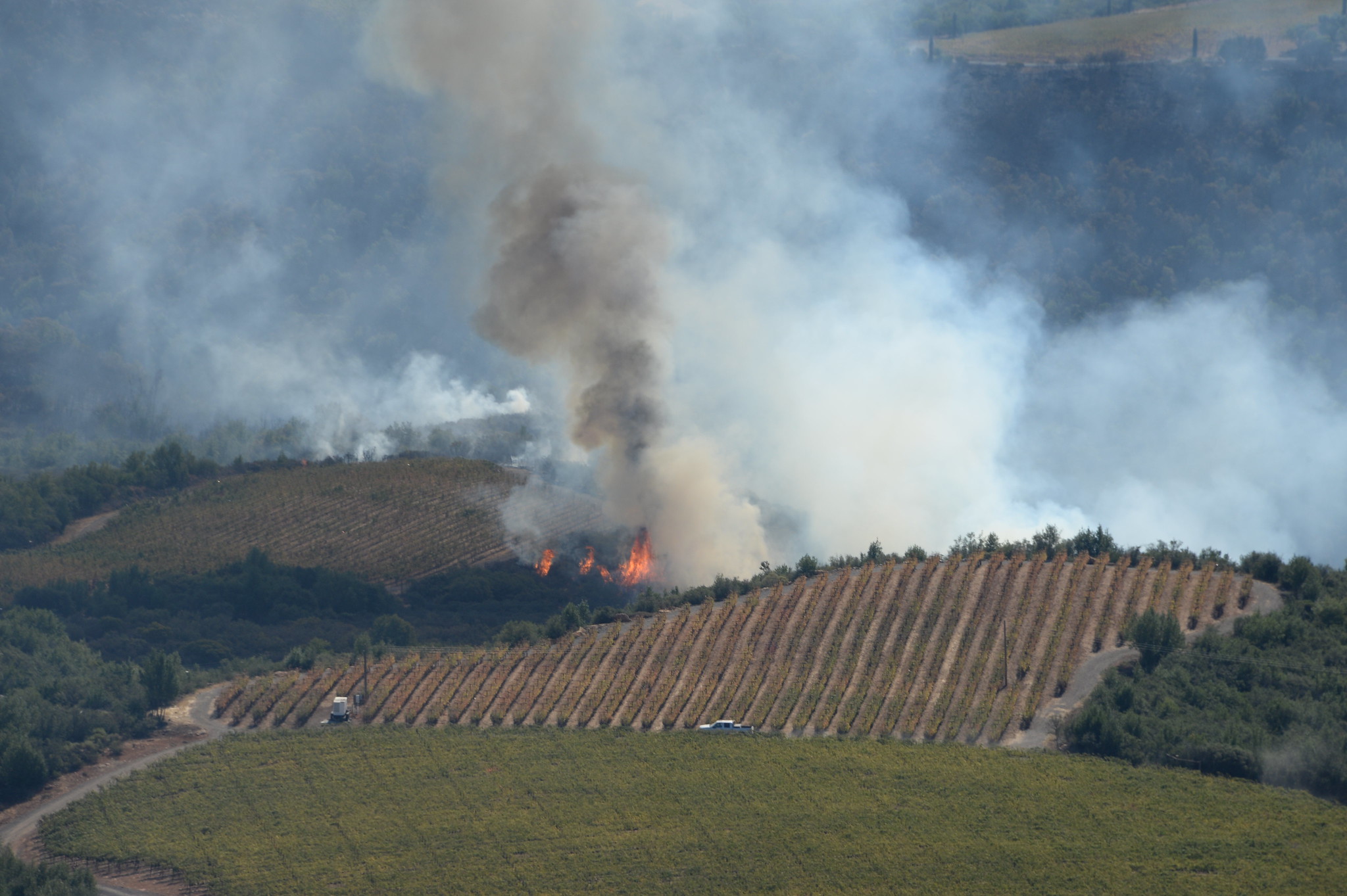
Greenbelt Alliance home About Us What We Do Get Involved Resource Center Your Region Join Today!

Home > Resource Center > Reports

RESOURCE CENTER
· Press Room
  · In the News
  · Press Releases
· Reports
· Newsletters
  · Greenbelt Action
quarterly print newsletter
  · Greenbelt Newswire
monthly email update
· Links
   
RELATED LINKS
· Join Greenbelt Alliance
· Greenbelt Alliance in Your Region
   

Sign up for the Greenbelt Newswire and Outings Calendar:


WWW SiteSearch

Reports

Greenbelt Alliance provides research and reports on open space and livable communities issues to help policy-makers and citizens make informed decisions.

Browse these reports organized by topic area below. You will need Adobe Reader to view some of these reports. Click here for the order form for the reports that you cannot download.

Latest Report

"Greenbelt Alliance's new guidebook will give local leaders practical tools to encourage climate-friendly development in their communities." 
– State Senator Darrell Steinberg, author of SB 375, California's first
legislation connecting land use to climate change

Smart Infillsmart infill

Smart Infill is a practical guide to help elected leaders and local residents invest in their communities to create inviting neighborhoods where people can afford to live.

The report provides strategies to encourage better development, with examples from cities all over the Bay Area.

October 2008

Report Index

Housing/Livable Communities
Land Use and Planning
Open Space/Bay Area's Greenbelt
Transportation
Annual Reports
Greenbelt Action Newsletter Archive


Housing/Livable Communities

Through the Roof: Solano County's Housing Crisis
A new report by Greenbelt Alliance, the Solano Housing Coalition, and the Non-Profit Housing Association finds that in spite of Solano County's booming housing growth, local families and workers are struggling with an affordable housing crisis. Eighty percent of Solano County residents cannot afford the median-priced home. The report finds that the housing market in Solano County is unbalanced, producing many more expensive houses than are needed on the region's outskirts, and not enough starter homes, apartment, townhomes, and condominiums within cities. To include more affordable homes in cities, the report recommends that the county's largest cities—Fairfield, Vacaville, and Vallejo—adopt inclusionary housing ordinances. Inclusionary policies require all new residential developments to include housing that is affordable to people making less than the median income. This ensures that people like nurses, teachers, and retail workers can live in the communities they serve. This in turn cuts down on long commutes and the resulting traffic and air pollution, while easing pressure to develop the county's working farms and natural areas. (17 pp, October 2005)

To download a free copy of the report, click here (1.5 MB pdf, 6 minutes via 56.6 kbps modem)

Housing Crisis Report Card
This report card reveals why the San Francisco Bay Area continues to have a housing crisis, and how local governments can help end it. A major cause of the crisis is that 72% of the regions' cities and counties are failing to take basic steps to address the Bay Area's affordable housing shortage.

There is a set of solutions that can provide a range of housing choices for everyone. The Housing Crisis Report Card examines the extent to which cities and counties are adopting common sense strategies for affordable housing. It takes a closer look at 40 key cities and counties, selected because they are among the largest and fastest growing places in the Bay Area. (28 pp, June 2002) Learn more by downloading the report. (695 KB pdf, 3 minutes via 56.6 kbps modem). To buy the publication, click on the button below to go to the Non-Profit Housing's order form.

Smart Infill
This 72-page guidebook for civic leaders and citizens shows how the region can achieve more livable communities and more sustainable development by developing underutilized land within existing urban areas. The report presents 12 key strategies to bring about well-planned infill housing and mixed-use development. These recommendations include zoning changes, design guidelines, public participation processes, revised parking requirements, and preparation of "Specific Plans" coordinating neighborhood revitalization.

In addition to providing a useful toolbox of strategies for smart infill, the guidebook features photos and case studies of successful infill throughout the Bay Area. In these examples, municipal action is already helping revitalize neighborhoods or entire cities and providing much-needed housing for people at different income levels. (72 pp, March 2002) Download the report. (5.7 MB pdf, 23 minutes via 56.6 kbps modem).

Room Enough: Housing and Open Space in the Bay Area
Room Enough demonstrates how the Bay Area's housing needs can be met without compromising the greenbelt. This study presents detailed alternatives to the current development pattern of low-density suburban growth. (64 pp, May 1983)

back to top

Land Use and Planning

scorecardBay Area Smart Growth Scorecard
The Smart Growth Scorecard is a landmark assessment of the planning policies of all 101 cities and nine counties of California's San Francisco Bay Area. This award-winning report found that the region could be doing much more to prepare for the growing population. On average, cities score 34%, with only one-third of the needed policies to achieve smart growth. Counties are doing somewhat better than cities, scoring 51% on average, meaning they are doing half of what they could do to prepare for the region's growth. (32 pp, June 2006) To obtain a free download, click here.

Toward a Bright Future: Updating Sonoma County's General Plan
The first comprehensive analysis of the update process since it began, this report recommends how to update Sonoma County's General Plan to deal with the county's projected growth of 130,000 people by 2025. (24 pp, November 2004) Right click the link and choose the option to save the file to download. Download the report (no cover, 1.2 MB pdf, 4 minutes via 56.6K modem). Download the report cover only (365 KB pdf, 1 minute via 56.6K modem).

Getting It Right? A Report Card on the Coyote Valley Specific Plan Process
The plan to date for development in San Jose's Coyote Valley is compared with the smart growth goals laid out in our vision, Getting It Right: Preventing Sprawl in Coyote Valley. So far, many aspects of the plan are on the wrong track. (16 pp, September 2004) Download the report (without the cover) by right clicking on the link and choosing the option to save the file. (129KB pdf, 20 sec. via 56.6 kbps modem). Download the cover. (1 MB pdf, 4 minutes via 56.6 kbps modem)

Preventing Sprawl: Farmers and Environmentalists Working Together
Greenbelt Alliance and the Sonoma County Farm Bureau led agricultural and environmental leaders in a collaboration to survey land-use patterns in the County in an effort to prescribe strategies for preventing sprawl and protecting agriculture. The report examines the past, present, and future of land use in Sonoma County. (38 pp, February 2004) Download the report by right clicking on the link and choosing the option to save the file. (1.8 MB pdf, 8 minutes via 56.6 kbps modem).

Getting It Right: Preventing Sprawl in Coyote Valley
Getting It Right was released in response to the City of San Jose's plan to allow development in Coyote Valley, a 6,800 acre area of open space and agricultural land on the city's southeastern edge. This report provides a template for smart growth not only in Coyote Valley, but also in other urbanizing areas throughout the Bay Area and across the nation. (June 2003) To obtain a free download, click here.

Contra Costa County: Smart Growth or Sprawl?
This in-depth analysis of Contra Costa's history of land use and growth includes a systematic evaluation of challenge and opportunities in East County, Central County, the Tri-Valley area, and West County, and also outlines the infrastructure and affordable housing situation in the county. It concludes with strategies for smart growth at both the city and the county level. (June 2003) Download the report. (4.33MB pdf, 16 minutes via 56.6 kbps modem).

back to top

Successful Citizens' Initiatives: A Guide to Winning Local Land-Use Ballot Measure Campaigns 2002 Edition
Ballot initiatives have been extremely effective tools for preserving open space and controlling suburban sprawl in the Bay Area, and can be tools for people throughout California and beyond. Greenbelt Alliance has been involved in land use ballot measure campaigns since the 1960s; over the years Greenbelt Alliance has learned many valuable lessons about the process of developing and winning citizen-based open space and anti-sprawl campaigns. This guide is not intended to be a substitute for professional campaign or legal advice—but it does lay out clear steps for citizens to take in contemplating, developing and winning local ballot initiative campaigns. This guide divides the components of a typical ballot initiative campaign into four sections: Getting Started, Qualifying the Measure, Election Rules and The Campaign.

Vacaville at a Crossroads: The path to smart growth or a highway to sprawl?
Learn about Vacaville's choices are as it grows in the next decade. Read the report and tell decision makers how you think Vacaville should grow. Download the file. (1.4 MB, 6 minutes via 56.6 kbps modem). (November 2002)

Urban Growth Boundary Bibliography
Searching for information on using UGBs for land use planning? Download Greenbelt Alliance's UGB bibliography. (October 2002)

back to top

Bound for Success:
A Citizen's Guide to Using Urban Growth Boundaries for More Livable Communities and Open Space Protection in California

Urban growth boundaries (UGBs) are becoming an increasingly popular land use planning tool throughout California and beyond. They are designed to offer long-term protection for open space and encourage smarter growth. This report explores the many advantages that UGBs offer over traditional land use planning tools, provides activists with a checklist of issues to consider as they organize their boundary campaigns, and discusses the various approaches to establishing a UGB. (April 1997)

Contra Costa County: Land Use or Abuse?
A comprehensive audit of development plans—and the enormous costs associated with those plans—in one of the Bay Area's most pro-development counties: Contra Costa. The audit reveals a massive tide of development threatening Contra Costa's dwindling farmland and other open space, and offers recommendations for preserving the county's endangered quality of life. (49pp, April 1996)

Beyond Sprawl: New Patterns of Growth to Fit the New California
A critique of post-war sprawl, published in conjunction with the Bank of America. Click here to view the report. (January 1995)

Reviving the Sustainable Metropolis: Guiding Bay Area Conservation and Development into the 21st Century
A concise report on how to resolve the San Francisco Bay Area's growing metropolitan problems, including urban sprawl, greenbelt destruction, and traffic congestion. Offers a short history of the region, an analysis of current land development trends and their consequences, a menu of policy solutions, and a fact-based appendix detailing the experiences of other regions—in the U.S. and abroad—in shaping metropolitan growth. (32 pp, June 1989)

back to top

Open Space/Bay Area's Greenbelt

At Risk: The Bay Area Greenbelt
This landmark analysis of the state of the region's landscapes determined that today, there are 401,500 acres of greenbelt lands at risk of sprawl development. That includes 125,200 acres at risk within the next 10 years, classified as high-risk land, and 276,200 acres at risk within the next 10 to 30 years, classified as medium-risk land. If current development patterns continue, roughly one out of every 10 acres in the entire Bay Area could be paved over in the next thirty years. (32 pp, May 2006)
To obtain a free download, click here. See more resources here.

The Greenbelt In Your Schoolyard
Activities for investigating urban nature. This teacher's guide contains five activities for grades 3-8 that aim to help young city-dwellers see how they are connected to the greenbelt. It includes hands-on lessons, discussion questions, and ideas for taking action. Through these activities, youth can find that the greenbelt is not just "out there" — it is also part of the everyday urban environment, and we all depend on the greenbelt for life. Each lesson takes approximately 45 minutes. (35 pp, 2005)
To obtain a free download, click here. To receive a printed copy of this curriculum (free to Bay Area educators), email us or call (415) 543-6771.

At Risk: The Bay Area Greenbelt (2000)
The 2000 survey of the status of all open land in the region, showing that nearly 500,000 greenbelt acres could be paved by sprawl in the next 30 years. Contains detailed statistics and computer-based maps for each county. (28 pp, January 2000) Download the report (without the title and table of contents). (2 MB pdf, 8 minutes via 56.6 kbps modem). The title pages can be downloaded separately (300KB pdf). Download the At Risk map (956KB jpg, after the larger map has downloaded and been downsized, place your cursor on the downsized map and an option to choose the enlarged version will appear).

The Bay Area's Farmlands
A classic report documenting the region's vibrant but still fragile agriculture and the people who are fighting to sustain it. The report also serves as a primer on what local residents can do to help protect the region's diverse and productive farmlands. (30pp, November 1991)

back to top

Transportation

Balanced Transportation: Achieving Congestion Relief and Meeting Transportation Needs in Solano County
This report describes the traffic problems in Solano County and the predicted 400% increase in congestion over the next 25 years, and offers alternatives to the highway widening and road-building which actually worsen the problem. These alternatives include smart growth planning, transit funding, open space protection, and pedestrian and bike safety improvements. Download the file. (208 KB, 1 minute via 56.6 kbps modem, June 2002).

Transportation for a Livable Solano County
This two-page document lists recommendations for funding transit including smart growth planning in a Solano transportation sales tax measure. Endorsed by: Solano Orderly Growth, Green Valley Landowners Association, Greenbelt Alliance, Bay Area Transportation and Land Use Coalition, and Amalgamated Transit Union, Local 192. Download the file. (March 2002).

Solano County Smart Growth Zones: Rewarding Cities that Plan for Livability
This fact sheet elaborates on the "Reward Smart Growth Planning" element in the Transportation for a Livable Solano County recommendations. Download the file. (May 2002)

Annual Reports

Click here to go to the annual reports archive.

Greenbelt Action Newsletter Archive

Click here to go to the newsletter archive.

back to top


  Home | About Us | What We Do | Get Involved | Resource Center | Your Region | Join Today 

©1995-2006 Greenbelt Alliance, 631 Howard Street, Suite 510, San Francisco CA 94105, 415.543.6771, info@greenbelt.org